By Joshua Burd
Gov. Phil Murphy has announced a long-awaited plan for a flood barrier at the southern end of Hoboken, although its location could threaten or dramatically alter a proposal to redevelop the rail yards alongside the city’s busy train terminal.
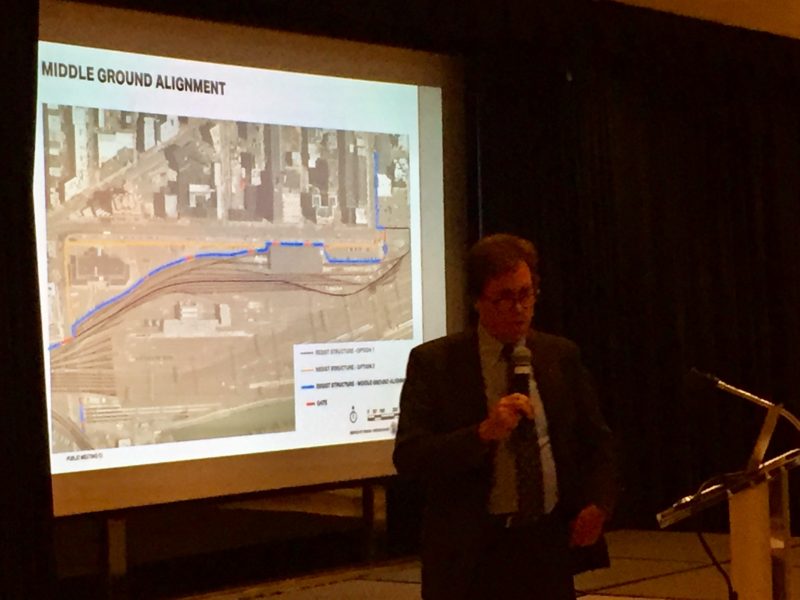
In a news release Thursday, Murphy said the location of the flood wall would be a “middle ground” between two options that state officials had been weighing for months. One alternative was a barrier with access gates that would run between the rail yards and Observer Highway — which would effectively kill the 2.3 million-square-foot redevelopment plan — while another option would place a flood wall farther south and provide a clear path for the project.
But in the hours after Murphy’s announcement Thursday, it was unclear as to how the middle ground placement would impact the redevelopment plan. A press release said the option would offer flood protection and minimize disruption to NJ Transit service, while still providing “a redevelopment opportunity in the area.” But a subsequent presentation by the state Department of Environmental Protection showed a concept in which the barrier cuts directly through the middle of a large portion of the 50-acre rail yards site, which is already long and narrow from east to west.
LCOR Senior Vice President Brian Barry, whose firm is the master developer of the site, said Thursday night that the firm was still reviewing the new concept.
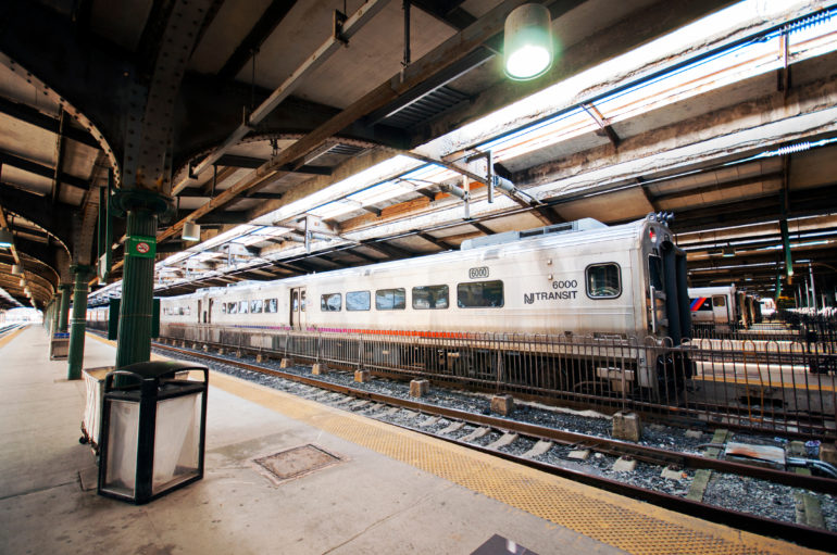
Redevelopment of the Hoboken rail yards is more than a decade in the making, but has also grappled with the aftermath of Hurricane Sandy in 2012. As such, the plan has hinged on where the DEP would build the flood wall under a federally funded resiliency program.
On Thursday, Murphy said the state opted for a middle ground after reviewing the project’s budget and federally mandated 2022 completion deadline, which is tied to $230 million in funds from the U.S. Department of Housing and Urban Development. He also referenced discussions with NJ Transit and local officials.
“This design selection is a win for Hoboken — now and in the future,” Murphy said. “It provides a reasonable, cost-effective system that will protect the city’s residents from flooding from the next major storm.”
The governor and other state officials said the design would protect key portions of the rail yard and the NJ Transit maintenance of way building, parking areas and other infrastructure. It would also allow the state to avoid permanently removing any tracks from service, while reducing the visual impacts of the structure on Observer Highway.
Hoboken Mayor Ravi Bhalla, who had publicly called on the state to make a decision about the flood wall, said Thursday that the alignment “will help protect our city and support our economic goals.”
“We believe that Hoboken can truly become a national model for innovatively dealing with the impacts of global climate change,” Bhalla said. “I thank Governor Murphy, the administration and our federal partners for moving this project forward.”
The Hoboken alignment is part of a larger effort — funded by the federal government’s Rebuild By Design project — that will span Weehawken Cove to the north and areas around NJ Transit’s Hoboken rail yard at the southern portion of city’s waterfront. Plans call for construction of flood barriers and storm water control systems to protect the low-lying neighborhoods, which were overrun by storm surges flooding during the 2012 superstorm.
Murphy said the design and selection process was closely coordinated with the communities involved and accommodated the desire to provide storm surge protection, while preserving waterfront access and views of the river and New York City skyline. The DEP has worked closely with a local steering committee to ensure robust public input in the design and selection process.
Construction is expected to begin in early 2020, Murphy and the DEP said.
What that means for the LCOR project could become clearer in the months ahead. As currently proposed, the plan calls for 1.5 million square feet of office space, 583,000 square feet of residential space and 129,000 square feet of retail and public space, along with the activation of Warrington Plaza and the ferry terminal building improvements.
The project would also transform Observer Highway into a boulevard-like environment and come with improvements to NJ Transit’s infrastructure.
Barry said earlier this year that the project has the potential to “effectively transform the southern gateway of the city,” tapping into the cachet of Hoboken and the demand for urban working and living options. That’s not to mention the benefits of a transit hub that serves roughly 50,000 commuters daily, with access to the quickly changing West Side of Manhattan.
Flood wall decision looms large for Hoboken rail yards project